Useful Links:
Eastern North Dakota River Gauges
Know how to sandbag: Information and instructional videos. (Look at the lower left side ) How to build a proper sandbag dike. How to not screw up your back while sandbagging. Other links provided on this page will help keep you safe during the flood, prep for the flood, and repair your property if you do have water damage.
http://www.wday.com/pages/AM970Radio basically up the minute information. Listen to help figure out who to call and where to go.
Phone Numbers:
General volunteer information for the Fargo-Moorhead area contact FirstLink at 701.476.4000
Property questions in Fargo
701-241-1545
Moorhead Information Line
218-299-5390
Moorhead / Clay County Evacuation Hotline
218-477-4747
West Fargo Hotline
701-433-5400
Cass County Flood Info
701-298-2370
Other Blogs With Red River Flood Information:
A blog dedicated to Fargo Flooding. Has one of the best Fargo river webcams, and lots of Fargo specific information.
http://redriverflood.ning.com/ Videos, pictures, and forum
Red River Flooding Web Cams:
Fargo Flood Cams:
I94 Bridge Cam 8 photos per 15 min
Grand Forks Flood Cams:
Click HERE to view the Herald’s Web-cam
Updated Three times a day. http://nd.water.usgs.gov/floodinfo/
River Data:
Red River Measurements at Wahpeton, ND
Red River Measurements at Fargo, ND
Red River Measurements at Grand Forks, ND
Red River Measurements at Drayton, ND
This post is updated as the spring events unfold.
Original Post:
Since I’m doing a post for Devils Lake I may as well do one for the Red River Valley. I have a feeling flooding could dominate my free time in the spring. It is seems likely that I will be volunteering for sandbagging in the spring, and after the river flooding subsides I’ll need to go help my dad pull old machinery out of the low areas near Devils Lake. My parents have a junk row that will probably go under in the spring if it isn’t moved.
As things stand right now it the Red River Valley can expect similar flooding to the flooding we saw in the spring of 2009. There is significantly more snow on the ground than last year, but the ground did have a little time to try out in the fall. The severity of the flooding will obviously depend on how much more snow we get, and how quickly it melts.
Update 1: March 8 2010
It looks like we could get up to three quarters of an inch of rain this week. It will be interesting to see if the rain triggers any short lived havoc in the area. In reality the rain may be a blessing in because it might partially melt the snow pack. Some water will be released slowly into the rivers rather than rapidly in a quick thaw.
Really, I do not expect anything crazy to happen for about a month, but I it is always possible things could start happening quickly.
If you happened to forget what things looked like last year….
http://www.boston.com/bigpicture/2009/03/red_river_flooding.html
Update 2: March 10 2010
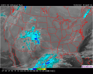
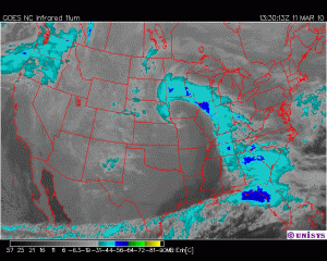
Doppler radar is indicating that an area North East of Grand Forks has received more than two inches of rain. It is hard to say whether or not the data is accurate, but if it is you should be able to see in the results in the river level and temperature in Drayton, ND. I will check tomorrow to see if anything is happening.
The weather forecast looks quiet after Friday or Saturday this week which may actually be a bad thing because long range forecast for next week are sunny with highs in the 40s. The rain will likely melt the snow pack to the point of being able to see some black dirt in the fields. Once the white snow cover is broken up there is a positive feedback affect that causes the snow to melt faster because black dirt absorbs much more of the solar energy than snow.
Cold nights should help slow the melting process, but it is possible that by the end of next week things could start to get interesting in the Southern Red River Valley.
Update #3 March 11 2010
It sounds like the Red River will reach flood stage in both Fargo and Wahpeton by Monday. Oh Joy…
It looks like the storm may have finally lost the ability to pull moisture in from the Gulf of Mexico.
Update #4 March 12 2010
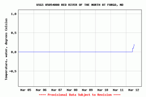
Water temp had moved just above freezing so whatever ice is left in the river in Fargo will soon break up. Down Stream can expect the same.
Update # 5 March 14
If you live in the Northern Valley Crookston could use some sandbaggers tomorrow.
Here is the release from the city this afternoon:
The City of Crookston is requesting volunteers to sandbag in Ward One-Sampson’s Addition.
Anyone wanting to help must report to the ward one command post at Oak Court, located at 110 Sargent Street, and be directed to the proper location from there. Volunteers should dress in layers, bring gloves, and wear appropriate footwear for muddy conditions. Your assistance in helping protect our community is greatly appreciated!
CONTACT NUMBER: Ward One Command Post- 218-281-6214
Update # 6 March 16
Just listened to the morning meeting for the Fargo area. Things actually sound pretty good. They still need volunteers, but they think they will hit their mark for sandbag numbers.
http://www.wday.com/pages/AM970Radio
The phone number given for flood information in the Fargo area is 297-6000. I’m pretty sure that is the number to call if you need sandbags or help protecting your property. Even if it’s not they will have the information you need.
Main media outlets are now doing a very good job of keeping people up to date for the larger cities. Some small towns still aren’t getting the attention they should, but that is sort of how things work out.


Sounds like so much fun. Hooray for sandbagging.
Thanks for the mention and all the other cool links!
Very great information.